
GREEN CITIES SERIES | ARTICLE 9
For fifty years, urban planners have travelled to Curitiba to study what happened when a young architect-mayor decided that a city was not, fundamentally, for cars. What they found was real, was replicable, and was also — when examined carefully — more complicated than the legend. The question now is what a fifty-year-old model tells us about the city it produced, and whether it still holds.
The bus arrives at the tube station on time. That is, in itself, a remarkable thing for a city of 1.9 million people in southern Brazil. The station — a cylindrical glass-and-steel shelter raised above the kerb, enclosed against rain and accessible from both ends — functions like a metro platform above ground: you pay before you board, the doors align with the bus doors, and the boarding takes seconds rather than minutes. The articulated bus pulls away, unhurried, in its dedicated lane while traffic eases around it on either side. This is Curitiba’s Rede Integrada de Transporte: the Integrated Transit Network, built on a principle so straightforward that it seems obvious in retrospect, and so routinely ignored elsewhere that Curitiba has been receiving international study tours for half a century to explain it.
The principle is that a city’s transport system and its land use must be designed together, not sequentially. In most cities, roads are built first and buses follow the roads, threading their way through whatever pattern of density and use has already accumulated. In Curitiba, the master plan preceded everything else: the bus corridors were designated, the land alongside them zoned for high density and mixed use, and the buses run in dedicated lanes down the spine of corridors that shape the city’s form rather than merely reflect it. The result, half a century in, is a city that uses roughly 30% less fuel per capita than comparable Brazilian cities, where around 70% of commuters travel by bus, and where the transit system is regarded — by residents and by the millions of urban planners who have studied it — as something approaching an urban amenity rather than a last resort.
And yet Curitiba now holds the highest private car ownership rate of any Brazilian capital city: around 0.63 cars per resident, more than twice the national average. The bus-oriented city and the car-glutted city are, improbably, the same place.
The Architect and the Master Plan
The story begins in 1965, when a group of young architects and planners at the Federal University of Paraná, dissatisfied with the existing urban plan, proposed a radically different approach to Curitiba’s growth. Their central insight was structural: the city was growing fast and would keep growing, and the decisive question was not how to manage that growth after the fact but how to orient it from the beginning. High density should follow transit, not roads. Green space should occupy the flood-prone river valleys rather than allow development to colonise them and then suffer the consequences. The historic centre should be for people, not cars.
It fell to one of those young architects, Jaime Lerner, to put the plan into practice. Appointed mayor in 1971 — not elected, but appointed by Brazil’s military government, a detail to which we will return — Lerner brought to the job an architect’s understanding that the city is a designed object, and a politician’s understanding that change requires speed and theatre as much as planning. When business owners threatened to reverse his pedestrianisation of the Rua das Flores, Curitiba’s main shopping street, in 1972, Lerner deployed hundreds of teachers and children to paint the newly car-free pavement. The motorists turned away. The street, now fifteen blocks long, remains one of the most vivid public spaces in Brazil.
Lerner served three terms as mayor between 1971 and 1992, and twice as governor of Paraná. The unusual duration and consistency of his influence gave Curitiba something that most cities cannot buy: the time to see long-cycle policies actually work. The BRT corridors needed a decade of adjacent development before the transit-oriented density that justified them had properly formed. The park system needed years of patient land acquisition — the city bought flood-prone areas cheaply, before they could be developed — before it could function as an integrated flood management network. Institutional continuity, embodied in IPPUC, the city’s independent urban planning institute, allowed each incoming administration to build on rather than dismantle what the previous one had established. That continuity is probably Curitiba’s least exportable quality and possibly its most important one.
The System in Full: Buses, Parks, and Rubbish as Resource
The BRT, when it launched in 1974, carried 54,000 daily passengers on its first twenty kilometres. By 2014, the network was carrying more than 2.4 million people per day. At its peak, approximately 70% of Curitiba’s commuters relied on the system, a modal share that rivalled metro systems in European cities but had been achieved at a fraction of the construction cost. A subway, the planners calculated, would have cost roughly 60 to 70 million US dollars per kilometre to build. The BRT delivered comparable capacity for a small fraction of that. The saving was not merely financial: it meant a transit-oriented city was achievable without the decades of construction and debt that a metro programme would have demanded.
The integration of transit and land use was the heart of the model. Along each BRT structural axis, the city mandated a trinary road system: a central busway flanked by high-density mixed-use development, with parallel access roads carrying slower local traffic on either side. The buildings that grew up along these corridors — residential towers with ground-floor retail, office blocks, medical facilities, schools — created the passenger density that the buses needed to be financially viable, and the buses created the accessibility that made development along the corridors commercially attractive. The two systems were each other’s justification. This reciprocal logic, which urban planners now call transit-oriented development, was first demonstrated at city scale in Curitiba.
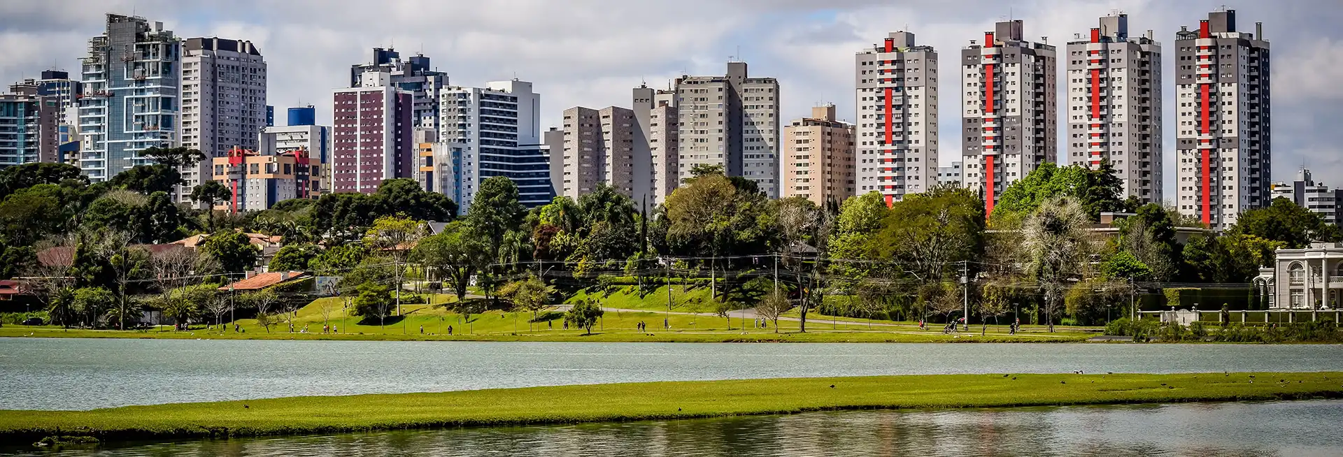
The park system was built on a different kind of integration: between urban green space and water management. Curitiba sits on a plateau, and its rivers — the Barigui, the Iguaçu, the Atuba and their tributaries — were prone to flooding as the city’s sealed surfaces expanded and rainfall ran off rather than soaking in. The conventional response would have been to build concrete channels and drainage infrastructure. Curitiba instead bought up the flood-prone riparian land, before development could claim it, and turned it into parks. Sixteen major parks, fourteen urban forests, and more than a thousand public green spaces now sit along the city’s river valleys. They absorb floodwaters that would otherwise have inundated streets and homes, at a cost estimated to be roughly 5% lower than conventional concrete infrastructure. They also provide 52 square metres of green space per resident — a figure that, at its peak, placed Curitiba among the greenest large cities in the world — and they are freely accessible to everyone.
The most quietly ingenious programme Lerner introduced, however, was the Câmbio Verde: the Green Exchange. In the favelas on the city’s periphery, where unpaved alleys meant that refuse trucks could not operate, waste accumulated and polluted local streams. The Green Exchange sent small trucks to these neighbourhoods on a regular schedule. Residents who brought sorted recyclable waste — bags of plastic, glass, metal, paper — received food in exchange: bags of vegetables, rice, beans, and eggs that the city bought at low cost from regional surplus production. Some 35,000 families participated monthly. The programme simultaneously cleaned the environment, reduced waste in watercourses, improved nutrition in the city’s poorest households, subsidised local agriculture, and laid the social infrastructure for a recycling culture that eventually reached a reported 70% of Curitiba’s garbage. It also treated the poorest residents as participants in the city’s environmental project rather than as obstacles to it.
The Cracks in the Classic Case Study
Urban planners who visit Curitiba today do not find everything intact. The most visible symptom of a system under stress is the cars. Curitiba’s success as an economic model — its per-capita income is around 66% above the Brazilian average, its human development ranking among the highest in the country — attracted migrants from across Brazil and created a prosperous middle class that, as its income grew, made the conventional choice of prosperous middle classes everywhere: it bought cars. The city now has the highest per-capita car ownership of any Brazilian capital. In the last two decades, ridership on the BRT system declined as middle-class commuters switched to private vehicles, finding the buses overcrowded, slow, and inconsistent. The very success of the economic model had eroded the civic compact on which the transport model depended.
Funding crises compounded the problem. Brazil’s recurrent economic and political turbulence through the 2000s and 2010s reduced investment in the BRT network’s maintenance and modernisation. Buses aged. Headways lengthened. The tube stations, gleaming in their original form, became dingy. A system that had been sold globally as an aspirational model was, in its home city, struggling with the accumulated stresses of decades of underinvestment and population growth that had outpaced infrastructure expansion.
The metropolitan problem was always latent and has become acute. Curitiba’s BRT network terminates at the city boundary. The metropolitan region — now housing around 3 million people in municipalities surrounding the core city — is poorly integrated into the system. Workers who commute into Curitiba from outlying municipalities face transfers between the integrated fare zone and suburban bus lines that have no integrated ticketing, meaning they pay twice. The critics who call Curitiba’s model a story of the well-served core and the neglected periphery are not wrong. The Rede Integrada de Transporte served around 1.8 million residents inside the city limits; it served the metropolitan poor considerably less well.
The model’s origins also deserve scrutiny that they rarely receive in the international literature. Lerner was not elected to his first mayoralty; he was appointed by Brazil’s military dictatorship. The speed and decisiveness with which he transformed the city’s streetscape — closing roads to cars overnight, creating pedestrian zones over business opposition, designating flood-zone land as parks before developers could contest it — was made possible partly by the suspension of normal democratic contestation. One prominent Curitiban civil rights lawyer, Darci Frigo of NGO Terra de Direitos, described the planning model frankly as ‘a technocratic approach without participation’ that ‘privileged certain groups.’ The demolition of favelas to accommodate the structural corridors — less discussed than the parks and buses in the international literature — displaced communities who had no formal recourse. Curitiba’s green credentials were built in part on foundations that democratic planning processes would have found much harder to lay.
A 2021 academic paper found that 46% of Curitiba’s current population still experiences precarious urban conditions, while only 25% has full access to urban amenities. The city that spends lavishly — beautifully — on landscaping still under-provides affordable housing. The ratio of parks to housing investment has, at various points, prompted the observation that Curitiba is a very good city if you can afford to live in it.
What the City Is Doing Now
The response to the BRT’s accumulated problems has been, in characteristic Curitiban fashion, structural rather than cosmetic. The Sustainable Mobility Programme, anchored in the city’s PlanClima climate strategy which targets carbon neutrality by 2050, aims for 33% of the bus fleet to be zero-emission vehicles by 2030 and 100% by 2050. The programme includes a new East-West BRT corridor connecting Curitiba to the neighbouring municipality of Pinhais, improving metropolitan integration — one of the system’s most persistent weaknesses. A new generation of BRT stations, incorporating air conditioning, real-time information, contactless payments, and WiFi, addresses the quality-of-service complaints that have driven middle-class riders back to their cars. The New Development Bank approved a loan in 2025 to fund improvements projected to increase average operational speed by 35%, reduce travel time by 25%, reduce CO2 emissions by 14%, and increase weekday passenger numbers by 5%.
The park network continues to expand. PlanClima includes the creation of new floodable green areas along the city’s six major river basins, 30 macrodrainage projects, and the ‘Water Reserve of the Future’: a series of connected lakes, drawing on former mines and other spaces, expected to reach roughly 26 kilometres in length, designed to provide water storage in times of drought. The logic is the same as the original park system — use natural infrastructure to solve what engineering can solve, at lower cost and with co-benefits — but updated for a climate future in which both flood intensity and drought frequency are projected to increase.
The urban agriculture programme, which dates to the mid-1990s, has established 43,968 square metres of gardens across the city since 2020, most of them small plots of around 30 square metres in schools and peripheral neighbourhoods. Over 360 beehives using native stingless bee species are being installed in municipal schools in 2024. The Câmbio Verde exchange continues, rotating through 100 neighbourhoods and serving some 35,000 families monthly. A second Urban Agriculture Hub is planned to open in 2025.
Most significantly, the city is revisiting its relationship with the metropolitan region. The IPPUC — the planning institute that has been the institutional backbone of Curitiba’s continuity since 1965 — is working on a Hypervisor system: a city-wide digital monitoring platform integrating transport data, environmental indicators, and urban development information in real time. The ambition is to extend the planning logic that shaped Curitiba’s core to the broader metropolitan area, creating the governance architecture that might finally bring the three million people outside the city limits into the integrated system that serves those inside it.
The Model and Its Limits
Curitiba’s international reputation has sometimes been a trap as much as an asset. The city has been studied so often, and celebrated so extensively, that the legend of what it achieved has become harder to update than the reality. Planners visiting in the 1990s saw something genuinely revelatory: a mid-sized South American city that had chosen a different path from the car-centric model that was then dominant almost everywhere, had built a transit system that worked for the majority of its residents, had turned flood-prone land into parks rather than concrete drains, and had designed social programmes — the Câmbio Verde most notably — that treated environmental and poverty problems as the same problem. All of that was real.
What the legend elided was the cost of the speed with which the model was imposed, the people it displaced, the metropolitan periphery it left poorly served, and the middle-class car boom that the model’s own success eventually generated. Curitiba is not a cautionary tale — it is a genuine and important contribution to the practice of urban planning, and its influence on BRT systems worldwide, which now serve over 31 million passengers daily in 168 cities, is among the most consequential urban policy interventions of the twentieth century. But it is also a fifty-year-old case study being updated for a different set of problems: metropolitan governance, climate resilience, affordable housing, and the long tail of prosperity that its own planning model helped generate.
Lerner, who died in 2021 at the age of 83, understood both the achievement and its incompleteness. ‘I have never liked calling it a model,’ he said in an interview later in his life, ‘because it is not paradise. We have our problems, we have favelas. What makes this city unique is its constant search for innovation and its commitment to simplicity.’ The search continues. The master plan is in its seventh decade of revision. The tubes are being modernised. The parks are growing. The cars remain, and the buses, and the question of who the city is designed for — the whole city, not just the parts that photograph well — is as live in Curitiba as it is everywhere else.
The City After the Legend
On the Rua das Flores, the pedestrian mall that Lerner defended with schoolchildren and paint in 1972, the shops are open on a Tuesday afternoon and the street belongs to the people walking it. A few blocks away, in Barigui Park, a shepherd tends a small flock of sheep grazing the flood plain. The sheep are not a decorative gesture: they are the city’s maintenance crew for a park that also manages the Barigui river in flood, and the arrangement is cheaper and less polluting than mechanical mowing. The Archimedes screw generator installed at the park’s waterfall turns water movement into electricity.
These details are characteristically Curitiban: practical, cheap, elegant, slightly eccentric, and integrated into something larger than they appear. The park is not just a park; it is a flood barrier, a carbon store, a recreational space, and a water storage system in drought. The sheep are not just sheep; they are a maintenance contract and a small agricultural enterprise. The pedestrian street is not just a street; it is a daily argument, renewed by footfall, that cities are for people. Curitiba’s lesson has always been that these things are connected, and that a city willing to design them as a system rather than a collection of isolated projects can achieve more, for less money, with less engineering, than cities that treat each problem separately. The lesson is fifty years old. It still applies.
Endnotes
1. Curitiba BRT founding: first 20 km opened in 1974, carrying 54,000 daily passengers in its first year; grew to over 2.4 million daily by 2014. Source: Streetsblog USA, ‘Curitiba: 50 Years of Lessons from the World’s First Bus Rapid Transit’ (October 2024); UITP, ‘From Curitiba to Dakar’ (2024).
2. Curitiba uses approximately 30% less fuel per capita than comparable Brazilian cities. Around 70% of commuters use the BRT at peak. Source: Reimagine!, ‘Curitiba Bus System is Model for Rapid Transit’; WIREs Energy and Environment, ‘The legacy of Jaime Lerner and Curitiba, Brazil’ (2022).
3. Curitiba’s per-capita car ownership: 0.63 cars per resident, highest of any Brazilian capital city, more than twice the national average of 0.27. Source: Americas Quarterly, ‘A Tale of Two Cities: Curitiba’; Next City, ‘Cracks in the Curitiba Myth’.
4. Jaime Lerner: first appointed mayor 1971 (not elected) by Brazil’s military government; served three mayoral terms 1971–75, 1979–84, 1989–92; died May 2021 aged 83. IPPUC (Institute of Urban Research and Planning of Curitiba) established under preceding mayor, providing institutional continuity. Source: Streetsblog USA (October 2024); Spatial Agency entry on Jaime Lerner.
5. BRT structural axis trinary system: central busway, flanked by high-density mixed-use development, with parallel slower-traffic access roads. Subway cost comparison: approximately $60–70 million USD per km vs BRT at a fraction of that cost. Source: Lessons from Sustainable Curitiba (Milwaukee Tool/OneKey Resources); Streetsblog USA (October 2024).
6. Park system: 16 parks, 14 forests, over 1,000 public green spaces. City purchased flood-prone riparian land before development could claim it. Parks serve as flood management infrastructure at approximately 5% lower cost than concrete drainage. 52 sq m of green space per resident at peak. Source: Smart Cities Dive, ‘The Vision of Jaime Lerner’; UN Sustainable Development Knowledge Platform, ‘Sustainable Urban Planning (Curitiba City)’; Dormakaba, ‘Green Spaces Transformation of Curitiba’ (October 2024).
7. Câmbio Verde (Green Exchange): trucks visit 100 favela neighbourhoods on rotation, exchanging sorted recyclable waste for bags of food. Approximately 35,000 families participate monthly. City achieves approximately 70% recycling rate. Source: Americas Quarterly; WIREs Energy and Environment (2022); Borgen Project, ‘Sustainability in Curitiba’ (June 2024).
8. 46% of Curitiba’s population experiencing precarious conditions; only 25% with full access to urban amenities: paper published in journal Urbe (2021), cited in Dormakaba (October 2024). On favela demolitions and housing shortage: Next City, ‘Cracks in the Curitiba Myth’ (citing Duarte 2012, Larbi). On ‘technocratic approach without participation’: Darci Frigo, co-founder Terra de Direitos, quoted in Next City.
9. PlanClima targets carbon neutrality by 2050; 33% of bus fleet zero-emission by 2030, 100% by 2050. New Development Bank loan (2025) for BRT rideability improvement project: projected 35% speed increase, 25% travel time reduction, 14% CO2 reduction, 5% passenger increase. Source: New Development Bank project page; ASCE, ‘Brazil’s Curitiba has been following its master plan for 60 years’ (July/August 2025).
10. ‘Water Reserve of the Future’: connected lakes from former mines, expected to reach approximately 26 km in length, providing drought-season water storage. 30 macrodrainage projects across six river basins. Source: ASCE (July/August 2025).
11. Urban Agriculture Programme: established mid-1990s; since 2020 created 43,968 sq m of gardens; second Urban Agriculture Hub planned 2024/25; over 360 stingless beehive installations in municipal schools from 2024. Source: AIPH, ‘Green City Case Study: Curitiba — Urban Agriculture’ (July 2025).
12. BRT concept replicated globally: 168 cities operating BRT lines serving over 31 million daily passengers. Source: UITP (2024); BRT Centre of Excellence, ‘Urbanism Hall of Fame: Jaime Lerner’. Lerner’s ‘not a model’ quote: Americas Quarterly interview. Lerner death: May 2021 at age 83, multiple sources.
Source Note
This article draws principally on Streetsblog USA’s 50th anniversary BRT assessment (October 2024), the ASCE Civil Engineering magazine’s comprehensive 2025 feature on Curitiba’s master plan legacy, the UITP’s 50th anniversary BRT seminar materials (November 2024), and WIREs Energy and Environment’s scholarly treatment of the Lerner legacy (2022). Critical perspectives are drawn from Next City’s ‘Cracks in the Curitiba Myth’, Americas Quarterly’s ‘A Tale of Two Cities’, and Darci Frigo’s remarks on planning and participation. Infrastructure financing is covered through the New Development Bank’s BRT improvement project documentation. Urban agriculture data comes from the AIPH case study (July 2025). Environmental performance figures draw on the UN Sustainable Development Knowledge Platform and multiple academic sources. The Borgen Project, Dormakaba, and Smart Cities Dive provided useful synthesis of Curitiba’s green space and recycling record.
Further Reading / Watching
Jaime Lerner, Urban Acupuncture (Island Press, 2014) — the closest thing to a first-hand manifesto from the planner who made Curitiba, written with characteristic lightness and accessibility.
Jonas Rabinovitch and Josef Leitman, ‘Urban Planning in Curitiba’ (Scientific American, March 1996) — still one of the clearest descriptions of how the integrated system actually works, written at the moment when the model was drawing the most global attention.
Ariadne dos Santos Daher, ‘Curitiba: 50 Years of Lessons from the World’s First Bus Rapid Transit’ (Vision Zero Cities Journal / Streetsblog USA, October 2024) — the most honest recent assessment of what has aged well and what has not, by a practitioner at the Jaime Lerner architectural practice.
A Convenient Truth: Urban Solutions from Curitiba, Brazil (documentary film, 2007, dir. Maria Vaz Photography/Del Bello Pictures) — a visually rich account of the city’s approach, still the most accessible introduction to the model for non-specialist audiences.